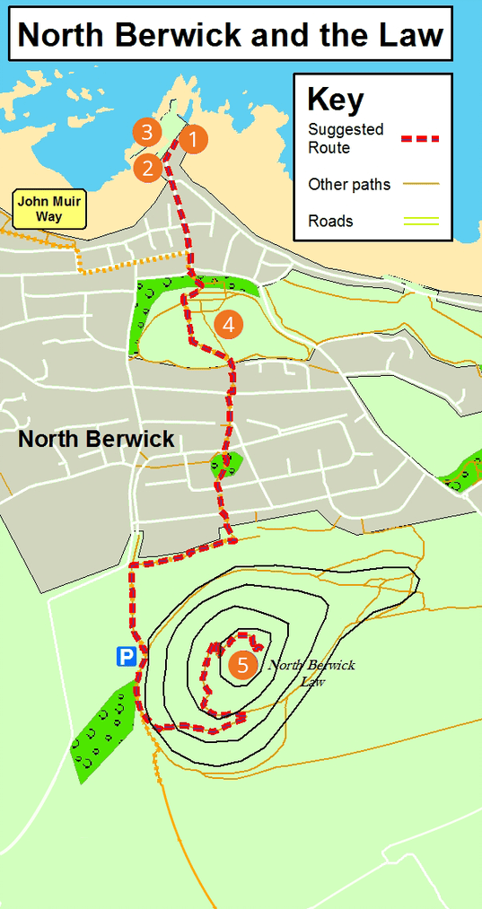
North Berwick and the Law
route information
| Start and finish: | Scottish Seabird Centre |
| Distance: | 3km / 2 miles (one way) |
| Time: | 1½ - 2 hours each way |
| Terrain: | Mostly paths and well-surfaced pavements. Steep climb (178 metres / 583 feet) to the top of the Law. |
| Directions: | Head south on Victoria Road and Quality Street; continue through the Lodge Gardens and Grounds keeping straight ahead to emerge on to St Baldred’s Road. Cross the road and continue straight on, following the John Muir Way signs. You will go through a small, wooded area and then across Gilbert Avenue and Lochbridge Road. Follow the path into Law View and turn right, with North Berwick Law on your left. At the end of this path turn left and follow the path to the car park. From here follow the signed path to the summit. |
| Public transport: | There are regular bus and rail service to North Berwick. |
| Local services: | There is a variety of shops and places to eat and drink. Public Toilets. |
points of interest
Scottish Seabird Centre
At the centre, there are lots of opportunities for learning about the amazing wildlife of the Firth of Forth and its islands.
St Andrew's Old Kirk
Ancient church with remains dating from the 12th – 17th centuries surrounded by a medieval graveyard. Recent excavations have identified even earlier remains.
Boat trips
Many operators sail from North Berwick Harbour.
Lodge Gardens and Grounds
Victorian designed Public Park.
North Berwick Law
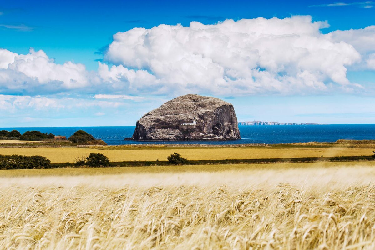
Remnant of ancient volcanic activity and is a typical ‘Crag and Tail’ land formation as a result of glacial erosion during the Ice Age. There is also an earlier Iron Age hill fort with evidence of prehistoric remains. The Napoleonic lookout shelter on the Law was subsequently used in WWI. There are great views of the Bass Rock, Craigleith, and the Forth islands from the summit.