
Outdoor Activities:
East Linton to Traprain Law
route information
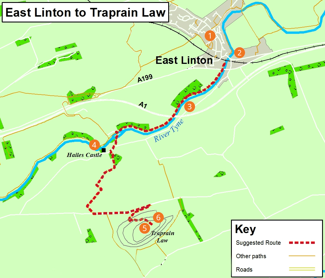
| Start: | East Linton |
| Finish: | Traprain Law |
| Distance: | 6km / 4miles (one way) |
| Time: | 2 - 2½ hours |
| Terrain: | Mostly earth paths and grassy tracks. Steep climb to Traprain Law (600 feet/180 metres). Undulating terrain. |
| Directions: | From East Linton's village square turn right along Station Road towards Haddington. About 50m after passing under the railway bridge look for a sign directing you left down a narrow road. At the bottom of this road the path turns right along the river. Continue until you reach the footbridge signed for Hailes Castle. Continue to the minor road from where a diversion west may be made to Hailes Castle. Retrace your steps and follow the signposted path to the Haddington Road. Turn left along the road to bring yourself to the foot of the Law; follow the direction signs to summit. |
| Public transport: | Regular bus services to East Linton from Haddington and Dunbar. |
| Local services: | There is a variety of independent shops and places to eat in East Linton. |
East Linton to Traprain Law - PDF download
East Linton to Traprain Law
points of interest
1
East Linton
Picturesque village dating from at least 12th century.
2
Tyne Bridge
Ancient 16th century bridge, part of the Great Post Road.
3
River Tyne
Look out for ducks, herons and dippers.
4
Hailes Castle
Ruins of the castle, parts of which date from the 13th century set in a picturesque location next to the river.
5
Traprain Law
Traprain Law is the location of prehistoric and medieval settlements. Associated with St Monenna and St Kentigern (St Mungo) in the 6th century. Great views of the Tyne estuary, Bass Rock, Craigleith, and the Forth islands.
6
Wild Ponies
Look out for the wild ponies who live on Traprain Law.