Driving Routes
If you like to tour by car then East Lothian’s Driving Routes will get you to the places you need to see and provide you with a unique insight into the region’s fascinating history and heritage and bring you right up to date with modern East Lothian. There are three routes to choose from, Hillfoots Trail, Saltire Trail & Coastal Trail, and if you have time we'd recommend doing all three! Each route has stopping points with interpretation boards which link to further information on things to see and do in the surrounding area.
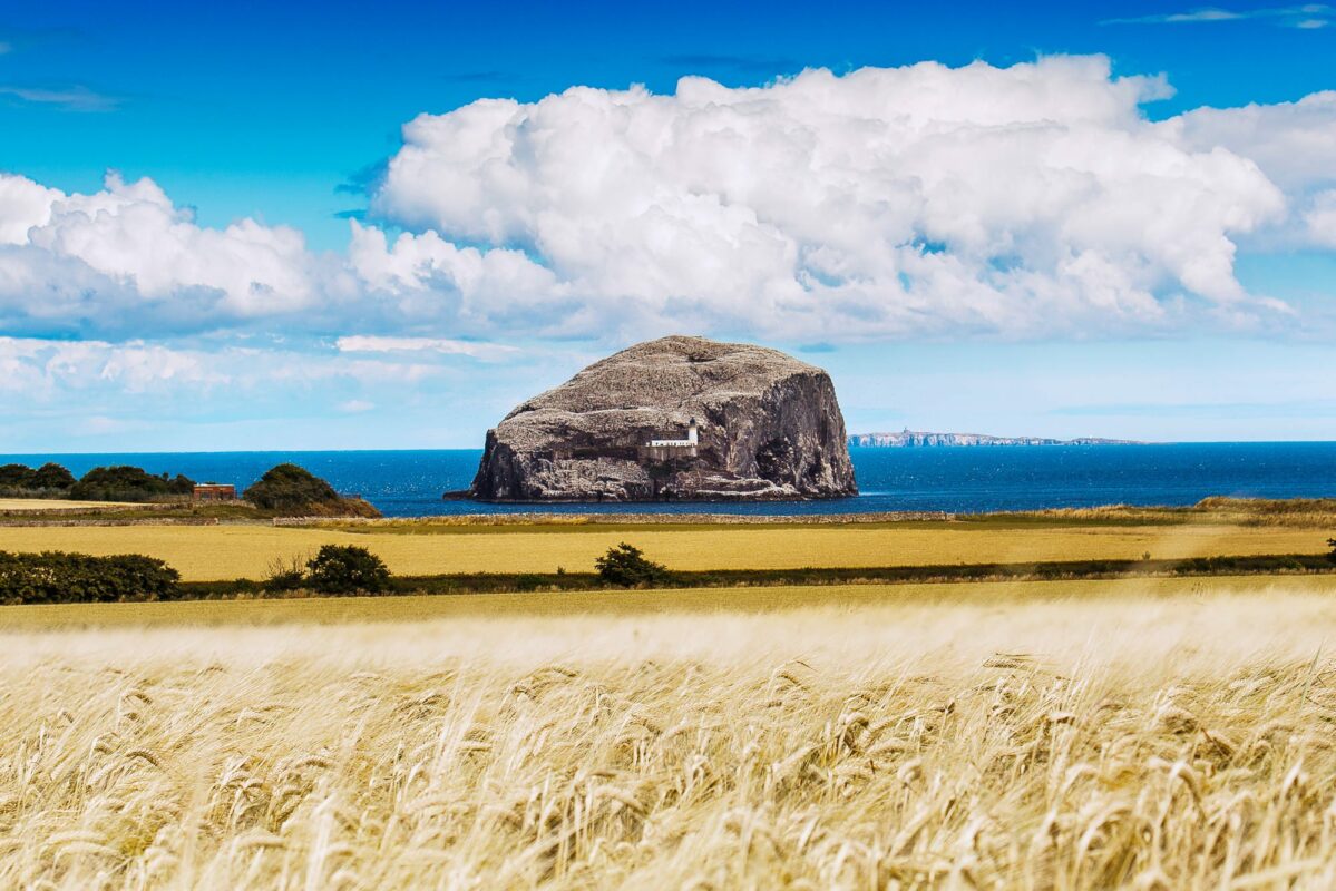
Choose The Coastal Trail and enjoy spectacular scenery, varied wildlife and top attractions. Follow The Saltire Trail and delve into Scotland's rich history, heritage and culture. Meander along The Hillfoots Trail through glorious countryside and traditional villages and take in panoramic views.
For information on Electric Vehicle Charging Points in East Lothian.
Parts of the routes are also suitable for exploring by bike and on foot. Find out about our cycling routes for all abilities and there's plenty of options for walkers.
Please respect other road users when following the routes - Love East Lothian Responsibly!
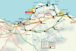


The Hillfoots Trail
Choose this route for - hills, countryside, wildlife, quaint villages & panoramic views!
Length: 35miles
Locations: Bilsdean / Stenton / Garvald / Gifford / East Saltoun / Pencaitland / Ormiston / Tranent / Musselburgh
The Lammermuir Hills, which guard East Lothian's southern flank, provided look-out points for ancient people at places like White Castle and Traprain Law. Later settlers, living in what was once part of Northumbria, lived in small farming communities or 'touns' whose names live on in places like Milton Newton and Bolton.
There are still remnants of the wildlife-rich woodlands that once grew on the slopes such as Pressmennan Wood with its walking trails. The hills have also given up a part of themselves; stone from Rattlebags Quarry built the houses of Garvald and many fine buildings elsewhere.
But it's the hillfoot villages along the Trail that add so much to the character of the area. They are all very different, well-separated, and some are even 'planned' where landlords built new settlements like Tyninghame or Ormiston.
Many have distinctive churches such as those at Gifford and West Saltoun. Pencaitland Church, with its three sundials, dates from the 12th century. In contrast, the modern Nunraw Abbey was built between 1952 and 1969.